
Baddow Ridge map
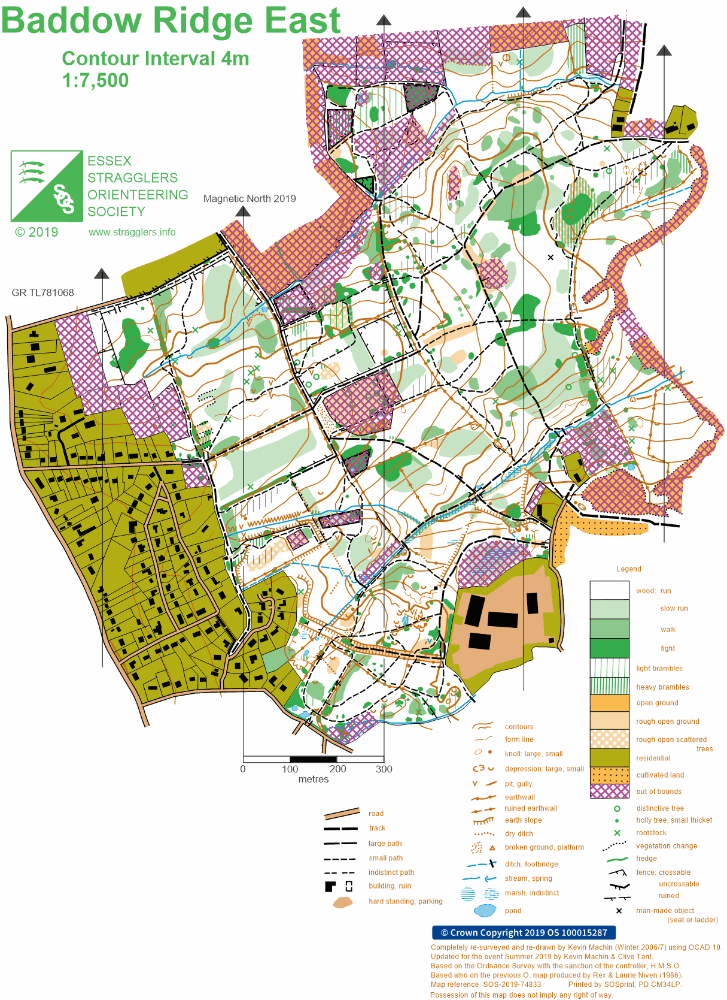
Baddow ridge east
Information
Conservation woodland to the north of Danbury map
Location
/0.5752,51.7243,12/500x400?access_token=pk.eyJ1IjoicGF1bGZyb3N0IiwiYSI6ImNreHB6M2ttMjBlbnkyd28yNXZzZWJwbGQifQ.fnwThkHVCLn8Nf1UM5_AYw)
Near: Chelmsford Lat,Lng: 51.7243,0.5752 OS Grid Ref: TL780060 Postcode: CM3 4DN What3Words: ///clotting.exists.lamppost
Open an interactive map in:
GoogleMap -
OpenStreetMap -
BingMap (OS 50k)